


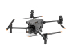
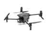
Mavic 3T
Redefining small industry drones. Compact and portable, powerful performance.
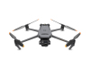
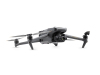
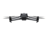
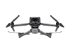
Redefining small industry drones. Compact and portable, powerful performance. Mavic 3E is equipped with a mechanical shutter wide-angle camera, a 56x zoom camera and an RTK module, supporting high-precision and efficient mapping and inspection operations. There is also a thermal imaging version, Mavic 3T, which is suitable for firefighting, search and rescue, inspection, night operations and other scenarios.
◆ Features
Compact and portable
4/3 CMOS wide-angle camera
Up to 56x zoom camera
640 × 512 thermal imaging camera
45 minutes of battery life
O3 image transmission industry version
RTK centimeter-level positioning
High-volume loudspeaker
Compact and portable
DJI Mavic 3 industry series is compact and small, can be held in one hand, easy to carry, and easy for one person to quickly deploy, suitable for front-line team flexible operation scenarios. Durable body, can cope with the challenges of long-term operation.
Wide angle
4/3 CMOS, 20 megapixels, mechanical shutter
Telephoto
Equivalent focal length 162 mm, 12 megapixels, 56x hybrid zoom
High-definition wide angle, high-speed continuous shooting
The wide-angle camera of Mavic 3E has 4/3 CMOS, 20 megapixels, supports mechanical shutter, avoids jello effect, and does not require image control. It can achieve the fastest 0.7 second interval continuous shooting, greatly improving the efficiency of surveying and mapping operations.
Low-light environment, continuous operation
The 3.3μm large pixel and intelligent low-light mode of the Mavic 3E wide-angle camera greatly improve the performance in low-light environments, increase the effective operation time during the day, and adapt to more operation scenarios.
High-definition zoom, patrol tool
Both Mavic 3E and Mavic 3T are equipped with 12 million pixel high-definition telephoto cameras, which support up to 56 times hybrid zoom and can see the target from a distance.
Super infrared, clear view
The Mavic 3T's thermal imaging camera has a resolution of up to 640 x 512, and supports point temperature measurement, area temperature measurement, high temperature alarm, color palette and isotherm functions, which can quickly locate the target and assist in operational decision-making.
Linked zoom, efficient comparison
The Mavic 3T's thermal imaging camera and visible light camera can achieve 28x linked zoom and continuous zoom, which is convenient for efficient comparison and confirmation of details.
Extremely long battery life, continuous operation
The cruising time is up to 45 minutes, and the effective operation time and operation radius are greatly improved. A single flight can complete the surveying and mapping of an area of 2 square kilometers.
100W charging butler, high-energy fast charging. The body also supports 88W fast charging, direct and fast charging, flexible operation.
Upgraded image transmission
4-antenna O3 image transmission industry version, 2-way transmission signal, 4-way reception signal. Both the aircraft and the remote controller support DJI Cellular modules. The 4G enhanced image transmission and O3 image transmission industry version can work simultaneously, easily coping with various complex environments and making flight safer.
Omnidirectional perception, safe flight
The fuselage is equipped with a fisheye lens, which can achieve omnidirectional perception without blind spots. It also supports setting warnings and braking distances to flexibly respond to different operational needs.
Intelligent return mode automatically plans the optimal return route, saving power, time and safety.
Supports APAS 5.0, and the drone automatically avoids obstacles, allowing you to fly with peace of mind.
Route optimization, efficient operation
Real-time terrain simulation:Based on omnidirectional perception capabilities, the drone can construct three-dimensional information in real time when facing undulating terrain. There is no need to import external data in advance, and it can also automatically imitate the terrain to ensure the accuracy of mapping.
Intelligent swing shooting:During the flight, the gimbal can swing forward, middle and backward to shoot. Two routes can collect high-precision three-dimensional models, greatly improving the efficiency of oblique photography.
Online mission recording:Record aircraft movement, gimbal pitch, photo shooting, zoom and other actions in real time, store them as route files, record once, and fly back multiple times.
Strip flight:Designed for strip areas such as roads, rivers, and pipelines, it can cut large strip measurement areas and plan routes in sections. The function is easier to use and the operation is more worry-free.
Professional software, continuous empowerment
Supports Pilot 2, efficient and easy to use, safe flight. Drone control and camera operation can be achieved with one click, mission information and flight status are clearly presented, and operations are more efficient; it also supports multiple route types.
Supports DJI Sky 2, which can mark points, lines and surfaces and build maps in the cloud, and efficiently coordinate air-ground command operations; it can also achieve efficient inspection operations through route task management functions.
Supports DJI Zhitu, creating efficient data collection and 2D/3D modeling solutions.
After completing thermal imaging operations with Mavic 3T, you can use the DTAT 3.0 infrared thermal analysis tool to mark, analyze, and process images to identify abnormal temperature points.
◆ FAQ
How to maintain a drone?
Maintaining a drone requires regular inspection and care. First, make sure the battery stays charged and avoid overcharging or discharging. Clean the fuselage, propellers, and camera regularly to remove dust and debris. Check the propellers for cracks or damage and replace them in time. Calibrate the gyroscope and GPS before flight to ensure stability. After flight, check the battery, motor, and control system to confirm that there are no abnormalities. Update the firmware regularly to ensure the latest performance of the device. In addition, avoid flying in adverse weather conditions to extend the life of the drone.
What is the safe operation guide for Drone?
First, make sure you are familiar with local laws and regulations before flying, and avoid flying in no-fly zones. Maintain line of sight during flight to avoid loss of control or signal. Check the status of components such as batteries, motors, propellers, etc. to ensure that the equipment is in good condition. Avoid strong winds, heavy rain or thunderstorms during flight to ensure stable flight. Comply with flight altitude restrictions to avoid collisions with buildings or people. Calibrate GPS and gyroscopes regularly to ensure accurate navigation. Finally, shut down the drone in time and store it properly after the flight.
How to extend the life of drone batteries?
The key to extending the life of drone batteries is to avoid overcharging and over-discharging. Before each charge, make sure the battery is between 20%-80% and do not wait until the battery is completely exhausted. Use the original charger and avoid using non-compliant charging equipment. Avoid flying in extreme temperatures, especially in overheated or cold environments, as high temperatures will accelerate battery aging. Use the battery regularly and avoid leaving it for too long when not in use. Charge it promptly after the flight to avoid the battery being in a low power state for a long time.
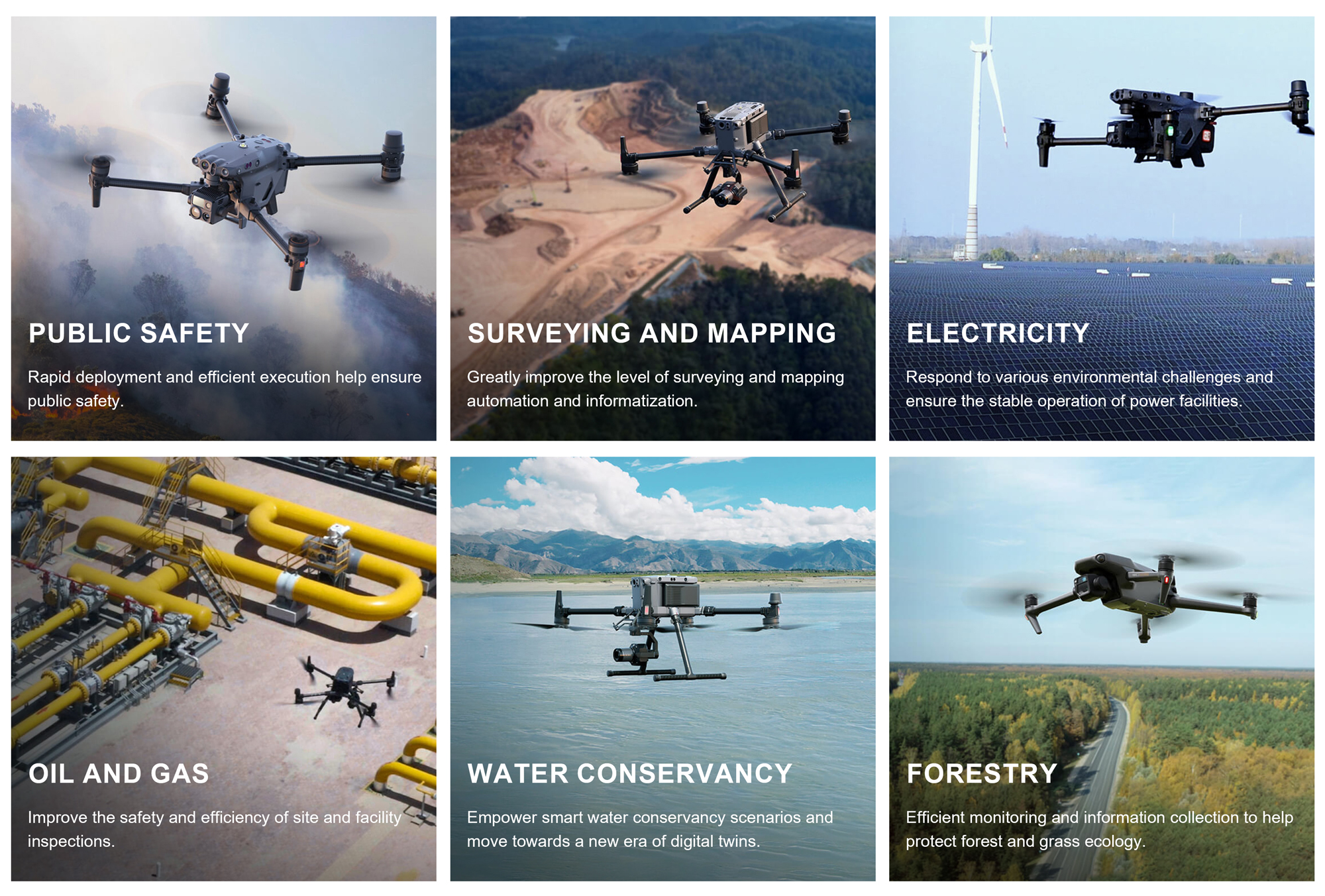
◆ Industry Applications
◆ Company Profile
Jiangsu Legend Intelligent Technology Co., Ltd. is a professional UAV industry application solution service provider. Relying on a complete service system and a good cooperation mechanism, it has become a deep partner of DJI industry applications.
Based on DJI industry application series products and relying on the East China UAV base, we build an ecosystem and six centers to provide customers with multi-dimensional and all-round solutions from top-level design to landing services. Help the fields of public security fire protection, power inspection, surveying and mapping infrastructure, urban management, etc., liberate productivity, reshape productivity, and build a link between technology and services.
Since its establishment, Jiangsu Legend Intelligent Technology Co., Ltd. has obtained various qualification certificates in the industry, and has become an industry leader through continuous in-depth exploration and exploration of the UAV field. It has established long-term strategic cooperation relationships with government and enterprise units such as Nantong Rudong Environmental Protection Bureau, Nantong Rugao Environmental Protection Bureau, Yancheng Funing State Grid, and Shandong Linyi Urban Management Center. It has continued to grow in solving practical problems, and gradually formed a win-win concept with cutting-edge technology as a technical means and personalized customization as a service purpose, to help the healthy and sustainable development of society. In the future, the company will continue to invest in research and development to increase its comprehensive competitiveness and actively deploy high-tech enterprises.

Contact US
Product Information
Quantity
Unit
Piece
Support order samples, customization, wholesale direct, and complete payment. If the product you look for does not have corresponding customized content, pls fill out the form below to contact us, and we will reply ASAP.