

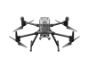
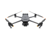
Matrice 30
The compact fuselage structure and powerful power system bring higher operating efficiency.
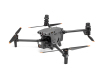
The compact fuselage structure and powerful power system bring higher operating efficiency.
◆ Features
Maximum flight time 41 minutes
Wind resistance 12 m/s
Maximum flight altitude 7000 m
Maximum flight speed 23 m/s
▶ Wind and rain unhindered
The drone has an IP55 protection level, and the working environment temperature range is -20° C to 50° C, which can easily cope with extreme harsh environments.
▶ Safe and reliable
The fuselage has binocular vision and near-infrared sensors in all 6 directions, which can avoid obstacles in all directions and ensure flight safety. The built-in ADS-B signal receiver can timely warn of surrounding manned aircraft information.
▶ Redundant guarantee
Multiple redundant systems allow you to safely cope with harsh operating environments and major tasks, and be prepared for emergencies.
▶ Image transmission reliability upgraded again
4-antenna O3 image transmission industry version, 2-way transmission signal, 4-way reception signal, and supports up to 3-way 1080p image transmission at the same time. Supports DJI Cellular module 4, 4G network image transmission and O3 image transmission industry version can work at the same time, easily cope with various complex environments, and fly safer.
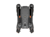
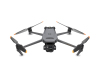
▶ Lightweight and portable, ready for action at any time
The highly integrated body makes it compact and easy to carry. You can set off at any time and deploy quickly.
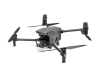
▶ The target is always under control
The M30 series highly integrates wide-angle, zoom, thermal imaging (only included in M30T) and laser ranging sensors, so you can keep track of your target no matter how far away you are, day or night.
· Wide-angle camera
Equivalent focal length: 24 mm, field of view (DFOV): 84°
1/2'' CMOS sensor 12 million effective pixels
4K/30 fps video resolution
· Zoom camera
1/2'' CMOS sensor 48 million effective pixels
5x~16x optical zoom, maximum 200x hybrid zoom
8k photo 4K/30 fps video resolution
· Thermal imaging camera
Equivalent focal length: 40 mm
Resolution: 640×512@30Hz
Temperature measurement accuracy: ±2℃ or ±2%
· Laser rangefinder
Measuring range: 3~1200 meters
Accuracy: ±(0.2m+D×0.15%)6
▶ Super image performance
Night flight: After the zoom camera turns on the intelligent low-light shooting mode, it can take detailed target photos in dark environments.
Smart low light: After the zoom camera turns on the smart low light shooting mode, it can take pictures of the target with clear details in a dark environment.
Visible light: Even in backlight or dark environment, the infrared camera can effectively see through.
Infrared: Even in backlight or dark environment, the infrared camera can effectively see through.
Laser ranging: One-click dot positioning to quickly obtain the target position.
▶ Industry-specific remote control
The 7-inch high-brightness large-screen DJI RC Plus remote control supports dual control mode and is tailored for industry users.
No fear of harsh environment
IP54 protection: waterproof and dustproof, wind and rain.
-20° C~50° C: No fear of severe cold and heat, can operate all day long.
More stable image transmission and longer battery life
Four-antenna O3 image transmission industry version: dual external antennas can be replaced; covering more operating scenarios, and the image transmission signal is more stable.
DJI Cellular module: 4G network image transmission and O3 image transmission industry version can work at the same time, making flight safer. Support mobile network access, convenient use of various network services.
Ultra-long battery life: The internal and external batteries can be used together, with a maximum battery life of 6 hours; the external battery can be hot-swapped, supporting seamless rotation operations, without fear of battery life pressure.
▶ New Pilot 2 flight mission software
The new functional design and interactive interface greatly improve the operation efficiency and flight safety.
New layout, double efficiency
UAV control and camera operation can be achieved with one button, mission information and flight status are clearly presented, and the operation is more efficient.
Hands on the stick, efficient operation
With the screen edge buttons, wave wheel and custom buttons, it is easy to achieve quick operations such as target marking and camera switching, and realize smooth operation without taking hands off the stick.
Safe flight
Flight checklist: Comprehensive and efficient flight checklist allows you to quickly confirm the aircraft status and parameter settings, and set sail with peace of mind.
Flight status monitoring: Key information such as Home point, target point, obstacles, etc. is clear at a glance, so that the flight will not be lost and the operation will be safer.
Risk warning: Timely and accurate warnings, comprehensive information control, easy to deal with emergencies.
▶ New Pilot 2 flight mission software
The new functional design and interactive interface greatly improve the work efficiency and flight safety.
New layout, double efficiency
UAV control and camera operation can be achieved with one button, and the mission information and flight status are clearly presented, making the operation more efficient.
Hands on the stick, efficient operation
With the screen edge buttons, wave wheel and custom buttons, you can easily achieve quick operations such as target marking and camera switching, and achieve smooth operation without taking your hands off the stick.
Safe flight
Flight checklist: A comprehensive and efficient flight checklist allows you to quickly confirm the aircraft status and parameter settings, and set off with peace of mind.
Flight status monitoring: Key information such as Home point, target point, obstacles, etc. is clear at a glance, so that you will not get lost in flight and the operation will be safer.
Risk warning: Timely and accurate warnings, comprehensive information control, and easy response to emergencies.
▶ Efficient air-ground collaboration
Quickly obtain geographic information
DJI SKY 2 has a 2.5-dimensional basic map that provides comprehensive geographic information. You can also quickly obtain the latest status on site through one-click panoramic, visible light or infrared cloud mapping functions.
Live broadcast
Supports low-latency high-definition live broadcast of multiple drones to understand the dynamics of the front line in real time.
Marking and synchronization
Targets can be marked, routes can be planned, and work areas can be allocated on the remote control, mobile device and computer, and synchronized in real time. The instructions are clear and the division of labor is clear.
Team information sharing
Information such as the location of team members, drone status and tasks can be shared in real time on multiple terminals, making team collaboration easier than ever.
▶ Automatic flight, repetitive operations
Route planning and management
Route intercommunication is achieved between DJI SKY 2 cloud platform and Pilot 2.0. Various complex routes can be planned, managed and synchronized more conveniently based on the cloud platform. Operation data can be automatically uploaded to the media library. Efficient management for repetitive operation scenarios.
Precise re-shooting
Precise re-shooting is upgraded again. Software interaction optimization saves 90% of the operation steps, making route task recording and target point marking more convenient; the gimbal is adjusted in advance during waypoint flight, the speed of taking pictures is increased, and the efficiency of single-flight inspection operations is significantly improved.
▶ DJI Airport, sticking to the unmanned area
All-weather operation
DJI Airport (only compatible with the M30 series Airport version)7 has an operating radius of 7 kilometers8, supports 7×24 hours all-weather operation, has an IP55 protection level, can work in an ambient temperature range of -35℃~50℃9, and adapts to various harsh environments.
Efficient rotation
The airport is equipped with a fast charging module, the drone is charged when it returns to its position, and the TEC air conditioning system quickly cools the battery. It only takes 25 minutes10 to charge the drone from 10% to 90%.
Cloud platform management
DJI Skong 2 cloud platform realizes centralized management of airports and tasks, allowing drones to automatically take off and operate according to the set mission plan, and automatically upload and archive the operation results, realizing true unmanned operation.
Support private deployment
DJI Airport can also directly connect to third-party cloud management platforms through cloud APIs to achieve private deployment and access under various network conditions.
◆ FAQ
How to maintain a drone?
Maintaining a drone requires regular inspection and care. First, make sure the battery stays charged and avoid overcharging or discharging. Clean the fuselage, propellers, and camera regularly to remove dust and debris. Check the propellers for cracks or damage and replace them in time. Calibrate the gyroscope and GPS before flight to ensure stability. After flight, check the battery, motor, and control system to confirm that there are no abnormalities. Update the firmware regularly to ensure the latest performance of the device. In addition, avoid flying in adverse weather conditions to extend the life of the drone.
What is the safe operation guide for Drone?
First, make sure you are familiar with local laws and regulations before flying, and avoid flying in no-fly zones. Maintain line of sight during flight to avoid loss of control or signal. Check the status of components such as batteries, motors, propellers, etc. to ensure that the equipment is in good condition. Avoid strong winds, heavy rain or thunderstorms during flight to ensure stable flight. Comply with flight altitude restrictions to avoid collisions with buildings or people. Calibrate GPS and gyroscopes regularly to ensure accurate navigation. Finally, shut down the drone in time and store it properly after the flight.
How to extend the life of drone batteries?
The key to extending the life of drone batteries is to avoid overcharging and over-discharging. Before each charge, make sure the battery is between 20%-80% and do not wait until the battery is completely exhausted. Use the original charger and avoid using non-compliant charging equipment. Avoid flying in extreme temperatures, especially in overheated or cold environments, as high temperatures will accelerate battery aging. Use the battery regularly and avoid leaving it for too long when not in use. Charge it promptly after the flight to avoid the battery being in a low power state for a long time.
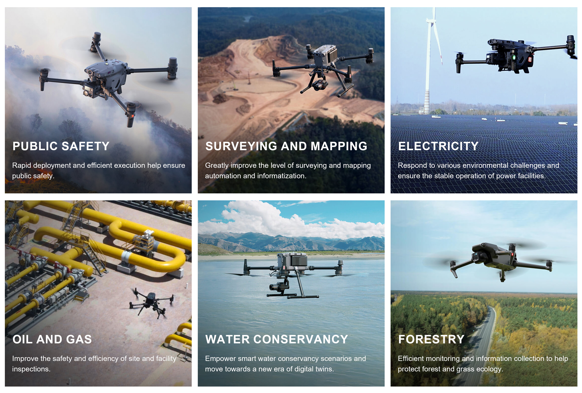
◆ Industry Applications
◆ Company Profile
Jiangsu Legend Intelligent Technology Co., Ltd. is a professional UAV industry application solution service provider. Relying on a complete service system and a good cooperation mechanism, it has become a deep partner of DJI industry applications.
Based on DJI industry application series products and relying on the East China UAV base, we build an ecosystem and six centers to provide customers with multi-dimensional and all-round solutions from top-level design to landing services. Help the fields of public security fire protection, power inspection, surveying and mapping infrastructure, urban management, etc., liberate productivity, reshape productivity, and build a link between technology and services.
Since its establishment, Jiangsu Legend Intelligent Technology Co., Ltd. has obtained various qualification certificates in the industry, and has become an industry leader through continuous in-depth exploration and exploration of the UAV field. It has established long-term strategic cooperation relationships with government and enterprise units such as Nantong Rudong Environmental Protection Bureau, Nantong Rugao Environmental Protection Bureau, Yancheng Funing State Grid, and Shandong Linyi Urban Management Center. It has continued to grow in solving practical problems, and gradually formed a win-win concept with cutting-edge technology as a technical means and personalized customization as a service purpose, to help the healthy and sustainable development of society. In the future, the company will continue to invest in research and development to increase its comprehensive competitiveness and actively deploy high-tech enterprises.

Contact US
Product Information
Quantity
Unit
Piece
Support order samples, customization, wholesale direct, and complete payment. If the product you look for does not have corresponding customized content, pls fill out the form below to contact us, and we will reply ASAP.