DJI drone technology helps forestry enter the stage of digital intelligent application

Recently, DJI, a global provider of civilian drone systems and solutions, and Yichun Forest Industry Dailing Forestry Bureau Co., Ltd. (hereinafter referred to as "Dailing Forestry Bureau") held an exchange meeting to explore the innovative practices of drone technology in forestry scenarios. The event attracted many media organizations to visit the Lesser Khingan Mountains forest area. Through field observations and interviews with industry users and the public, the media organizations learned about the importance of drones in forest fire prevention, emergency disaster relief, forest resource protection, etc., as well as how forest area staff can use technology to achieve modern forest protection and construction.
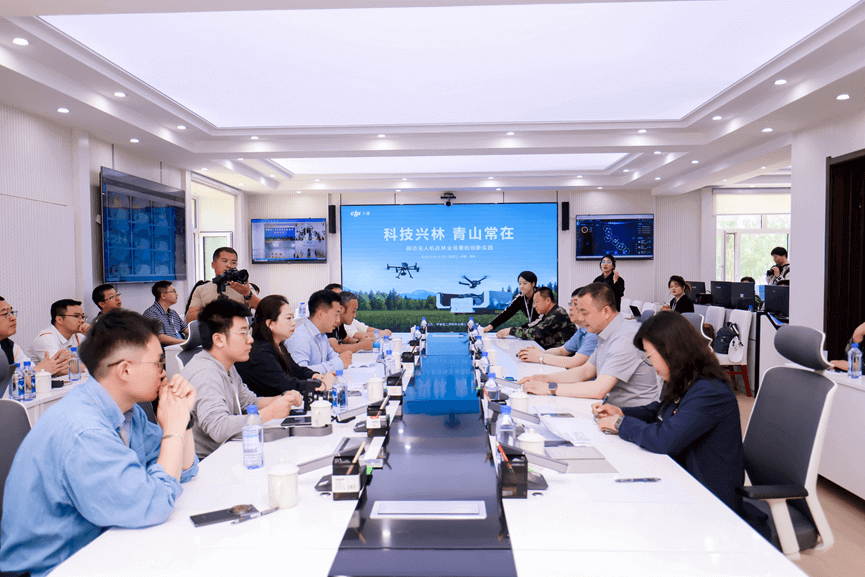
At the event, Li Jiyong, director of the Forest Fire Prevention and Safety Supervision Department of Dailing Forestry Bureau, shared the situation and results of how foresters seized the opportunity of the times and relied on their own forest resources and technological advantages to do a good job in forest fire prevention and ecological protection. Yang Teng, director of the forestry industry of DJI, explained the necessity of the current forestry stage for new technologies, why DJI has entered the forestry field, and the cases and advantages of drone technology in forest fire prevention, pest control, and wildlife protection.
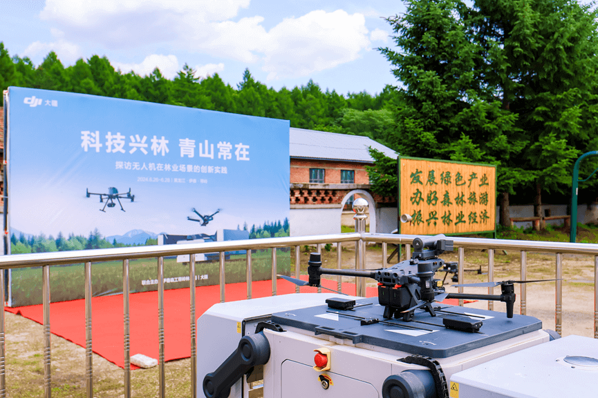
In March last year, Dailing Forestry Bureau took the lead in introducing DJI Airport's automated patrol solution, which included 9 DJI Airports (including the Latitude M30T Airport Edition aircraft), planned nearly 100 regular patrol routes, and completed about 2,000 flight missions so far, with a total flight distance of nearly 10,000 kilometers.
DJI Airports are deployed in 9 forest farm branches under the jurisdiction of Dailing Forestry Bureau and connected to the modern forestry management system. With the aerial technology advantages of drones, they effectively supplement the shortcomings of traditional patrol methods. At present, this "human-machine collaboration, air-ground complementarity" digital forestry patrol mode not only realizes normalized automated patrol operations in daily patrols, but also conducts all-round patrols of fire hazards, real-time monitoring of river flood conditions and road safety during special periods such as forest fire prevention and flood seasons, saving manpower while greatly improving the accuracy of patrols.
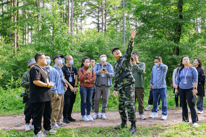
Patrolmen over the Lesser Khingan Mountains, starting the forestry automated patrol mode
my country's forest coverage rate is about 24%, with a forest area of 3.5 billion mu. Every day, more than 2 million forest rangers patrol the complex forest areas. However, traditional human patrol methods have many challenges in efficiency, accuracy and safety, and it is difficult to meet the needs of scientific management and ecological protection of forest resources.
Northeast forestry is the country's most important forestry resource area. The Lesser Khingan Mountains run through the entire territory of Yichun. It is a national key state-owned forest area and a national key ecological functional area. Especially in the resource-rich Dailing, the total standing stock of living trees is 15.41 million cubic meters, and the forest coverage rate is 96%. There are more than 270 rare animals such as Chinese merganser and red deer.
At the exchange event, Li Jiyong, director of the Forest Protection and Safety Supervision Department of Dailing Forestry Bureau, introduced that with the continuous development of science and technology, all walks of life are moving towards intelligent transformation. Dailing Forestry Bureau can provide a better view and fly farther through DJI drone patrols, and automated patrols can further liberate manpower. Li Jiyong introduced: "It used to take more than 2 hours for a patrolman to patrol 3 kilometers and 6 kilometers round trip. Now, drone patrols are used, and patrols are carried out every half an hour, which effectively improves the efficiency and frequency of patrols; drone patrols can also minimize the safety risks of staff, saving manpower while improving the accuracy of patrols."

Yang Teng, director of DJI's forestry industry, said that DJI has always been committed to promoting the progress of human civilization, constantly pursuing technological innovation, and developing efficient, safe and easy-to-use drone technology solutions. Yang Teng said at the exchange event: "In 2016, DJI began to have in-depth contact with front-line personnel in forest farms and forestry bureaus to explore the feasibility of drone applications in forestry. With the establishment of DJI's industry application department, DJI has also successively launched industrial drones that meet industrial standards, visible light, lidar and other functional loads, as well as a more intelligent and automated DJI airport series. In 2023, the 9 airports deployed by the Xiaoxing'anling Yichun Forest Industry Dailing Forestry Bureau Company were the first case of forestry customers nationwide using DJI airports for automated forest patrols. Today, the new airport has also been upgraded to be smaller in size, longer in battery life, and more automated."

"Technology helps forests", DJI provides the best solution for the industry
At present, the "human-machine collaboration, air-ground complementarity" digital forestry patrol mode implemented by the Dailing Forestry Bureau of Yichun Forest Industry Group has provided an application sample for drone technology in forestry operations. Taking the Lesser Khingan Mountains forest area as an example, the total area of the Dailing Forestry Bureau is 96,742 hectares, of which 92,883 hectares are forest land, and the forest coverage rate is as high as 96%. The risks hidden in the vast forests are all observed by the naked eye, and it is easy to leave blind spots and blanks. New technologies can not only help front-line forest rangers reduce the risks of daily patrol operations, but also improve operational efficiency and prevent risks such as forest fires, pests and diseases, poaching and illegal logging.
As global environmental and economic problems become increasingly severe, forests, as natural resources, play an increasingly important role in solving problems such as climate change, biodiversity reduction, and energy crisis. Humans are seeking more scientific and reasonable ways to develop and manage forest resources, and the advancement of science and technology has made this demand possible.
Since its establishment, DJI's Industry Application Department has been committed to changing the way traditional industries work through drone technology. Today, DJI's industry drones are used in forestry systems such as large and small forest farms, municipal and county forestry bureaus, national parks, and nature reserves across the country.
The core value of drone technology lies in its tool attributes. It prioritizes solving the practical problems and needs of front-line users, bringing intelligent productivity to front-line workers, reducing operational safety risks and improving operational efficiency. With the development and progress of technology, drones' autonomous control technology, networked communication technology and data processing capabilities have become increasingly intelligent and powerful. Visual imaging technology, infrared survey capabilities, more accurate LiDAR point clouds and intelligent target recognition algorithms have all made drone technology play an important role in daily forestry patrols, forest fire prevention, animal and plant protection, forestry resource surveys and other fields.
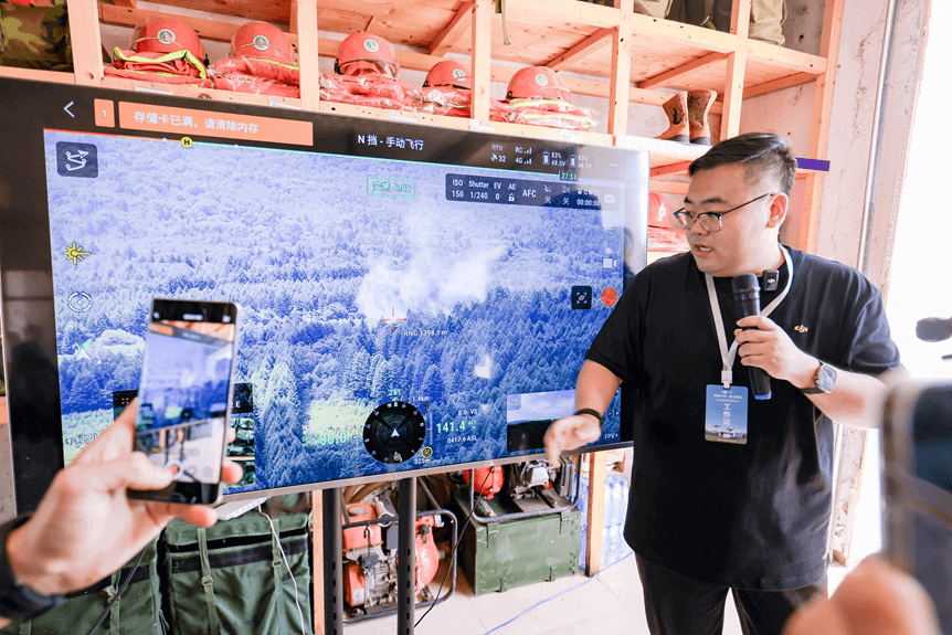
In daily patrols, the use of the unmanned operation platform "DJI Airport" can achieve 24-hour all-weather automated inspections, and improve the real-time and accuracy of monitoring by sharing patrol conditions in real time. In forest fire prevention and flood control emergencies, high-altitude reconnaissance will be more efficient. Drones lock heat sources through infrared modules, and high-definition cameras monitor floods, providing valuable real-time information for fire fighting command and emergency rescue; in forest resource surveys, high-resolution cameras, LiDAR and other sensors are used, and software such as DJI Zhitu is analyzed to obtain multi-type three-dimensional high-precision models to meet the needs of forestry survey business.
The National Forestry and Grassland Administration stated in its guidance on promoting the development of artificial intelligence in forestry and grassland that "(intelligent protection of ecosystems) should make full use of new-generation information technologies such as drones to realize intelligent ecological protection in the fields of forest ecosystem protection and grassland ecosystem protection."
By applying "new quality productivity" to the forestry field, DJI is providing the forestry industry with safer, more efficient and more intelligent operation methods and solutions, while opening up new paths for the harmonious coexistence of humans and nature.
From new quality productivity to promoting industry change, drone technology empowers thousands of industries
This year, "new quality productivity" was written into the "Government Work Report" for the first time, and the cultivation of new quality productivity in all walks of life is in full swing. Heilongjiang Yichun Forest Industry Group Dailing Forestry Bureau Company took the lead in introducing drone technology to empower the forestry industry, which is a typical embodiment of the new quality productivity development strategy. At present, DJI's forestry customers are spread across many provinces and cities across the country, from Fujian and Guangxi in the south to Hunan, Hubei, Jiangxi in the middle, and then to forestry companies in the Greater and Lesser Xing'an Mountains in the north. The widespread application of drone technology in forestry systems such as large and small forest farms, municipal and county forestry bureaus, national parks, and nature reserves demonstrates its great potential in improving forestry management efficiency and productivity.
In today's rapidly developing technological era, DJI drones are no longer just tools for aerial photography and entertainment, but have become pioneers in the transformation of many traditional industries. In Ganzhou, the birthplace of navel oranges, drones are responsible for the refined management of orchards in hilly terrain; on the island of Pingtan in Fuzhou, drones have ushered in the "unmanned inspection era" of power grids; in the Mianshan Scenic Area in Shanxi, drones use digital technology to protect the cultural heritage of ancient buildings; on the 6,000-meter Mount Everest, drones completed the world's first high-altitude material transportation... Drones have become an important role in many fields such as agricultural and forestry plant protection, emergency rescue, police patrols, cultural relics protection, and power inspections.
From precise agricultural assistance to rural revitalization, from ensuring energy security to serving the dual carbon goals, from ecological and environmental protection to supporting the construction of a national modern emergency rescue system and other policy responses, DJI is accelerating the empowerment of thousands of industries with advanced industry drone solutions, and popularizing drone technology to all walks of life through cost-effective and high-quality products and services. It continues to provide intelligent application solutions and services for many basic and important industries, promote industry efficiency improvement and productivity transformation, and promote sustainable social and economic development.
Related News


Contact US
Product Information
Quantity
Unit
Piece
Support order samples, customization, wholesale direct, and complete payment. If the product you look for does not have corresponding customized content, pls fill out the form below to contact us, and we will reply ASAP.